Procore enhances AI partnership with Microsoft
Users will be able to access AI features in Microsoft Teams.

Key Takeaways:
- Procore is integrating its AI assistant, Procore Copilot, further into the platform and with Microsoft Teams. This will allow users to ask questions about projects in natural language and get answers directly within Teams.
- New features like AI Locations will automatically generate project location lists and Procore Maps will offer better visualization of project progress through photos.
- Procore will leverage AI to surface key information on responses to requests for information (RFIs) and submittals, providing context on project requirements and industry benchmarks.
The Whole Story:
Construction management software provider Procore Technologies is deepening its integration with artificial intelligence.
Among the many solutions announced at Innovation Summit 2024, newly announced product updates give Procore customers deepened access to AI, improve field productivity, and drive efficient cost management:
Procore Copilot AI will further integrate into the Procore platform via Microsoft Teams. This upcoming integration will bring important project data and context directly from Procore into Microsoft 365. Procore Copilot AI users will then be able to simply ask questions about Procore projects in Teams, in normal, conversational language, and receive a complete summary of the pertinent information along with links to related information sources. Users will be able to search for, view, and attach Procore project information (such as requests for information (RFIs), Specifications, and Submittals) in work on calls, meetings, and chats.
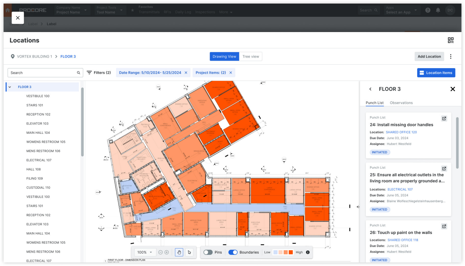
AI Locations will allow users to scan project drawings and automatically build out project location lists. This will unlock the ability to organize project items by location as they’re created in the field later on. Procore will also utilize AI to surface key information on RFIs and submittal response time, alongside context on project requirements and industry benchmarks.
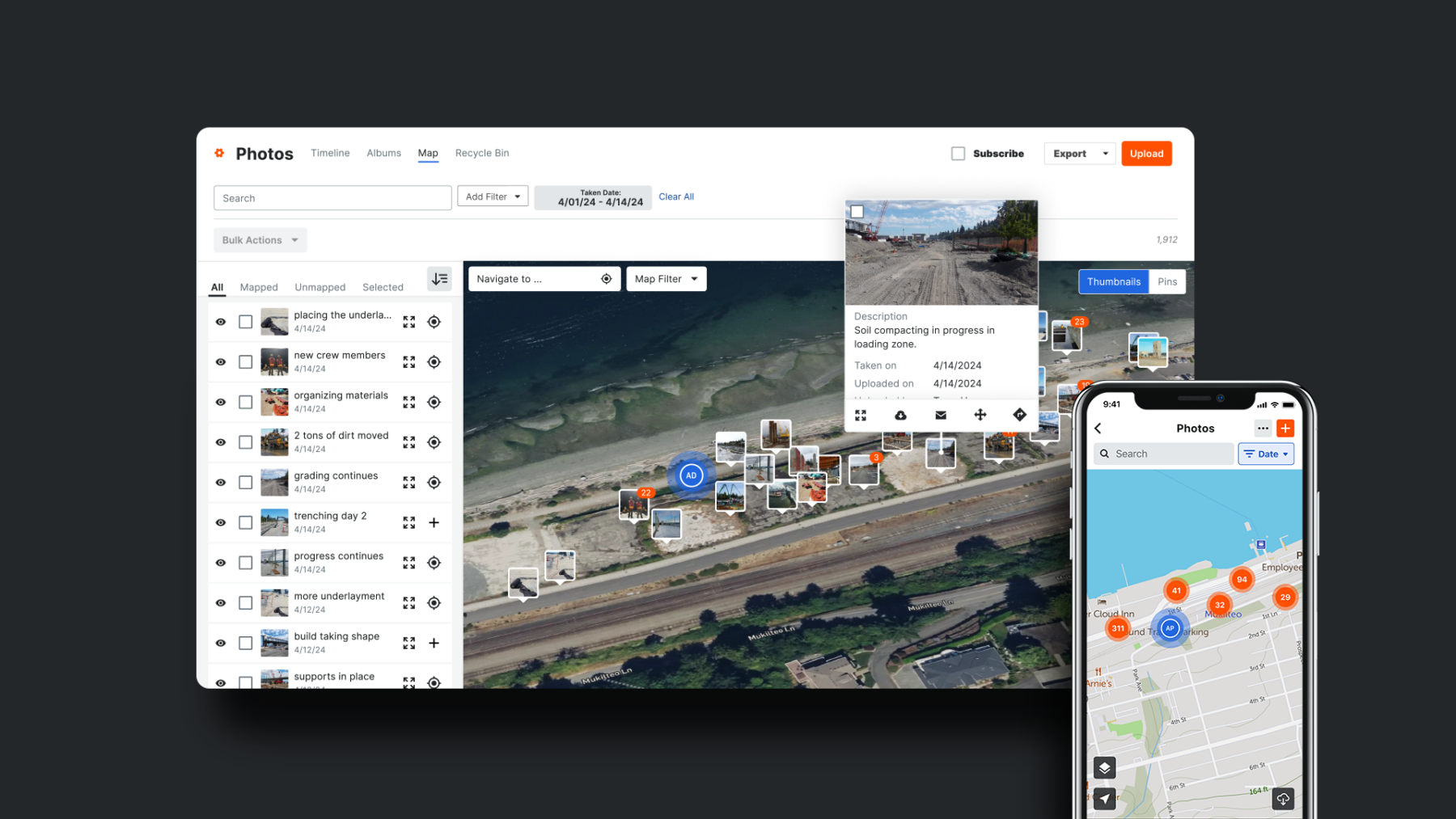
Procore Maps will enable viewability of photos on a map to understand work status across all areas of a project to help optimize workflows and reduce delays. Procore Maps will be able to filter photos on a map by date to pinpoint specific milestones or events captured during a project timeline.
Procore says this will streamline visual data and support smart decisions on the go. Users will also be able to navigate to where photos are captured directly from the map interface, providing context and clarity to team members regardless of their location.